In the morning, Kanchenjunga across the lake was shrouded in mist.
After breakfast, I immediately set off from HollyHowe (BankGround Farm) with our luggage. I passed in front of the primary school via the farm's footpath and headed to Coniston YH. This is another Holly How (YH Coniston Holly How).
The building is made of stacked slate stones. First, I choose my accommodation and dinner and breakfast from the menu at reception. It looks like I'll be able to eat a decent meal today. I left my luggage in my room and headed out immediately.
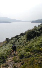
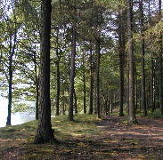
Although I thought I was in a hurry, I already missed the scheduled departure of the Coniston Lounch. So I changed my plan to walk south along the west shore of the lake. Halfway to the port, I joined the footpath that continues south. The footpath passed through sheep farms and past a campsite full of people. Eventually, as I walked along the lake shore and through the forest, the people dwindled.
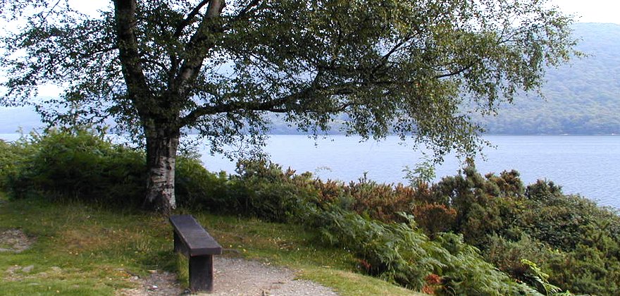
After walking for a while, I sat down on a bench overlooking Wildcat Island to rest. Now that I had reached the island of our dreams, I was able to relax and enjoy the view with satisfaction. From the SunnyBank wharf, the path left the shore and climbed a little way up a road overgrown with ferns. I then found ourselves walking on the edge of the road where cars passed. I walked along the paved road under the hot sunlight. On the cliff of the quarry that came into view on the right, heather bloomed in purple and reddish purple. The tiny flowers grow on the edge of the rocks like alpine plants, but the mixture of various purples makes for a beautiful sight. The yellow flowers of the gorse are also quite pretty.
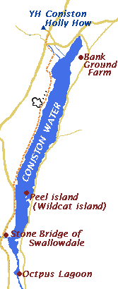
I walked along the road and I knew I was almost there, but I couldn't find the stone bridge over Swallow Valley. I looked at the map and realized I had mistakenly thought it was 2km away from the BrownHowe car park and had gone too far. I walked back along the side of the road where cars were passing by and found a sign for the Coniston Ranch boat dock. It said Lake Bank and I checked the map and realized I had gone too far and missed the stone bridge. I had no choice but to walk further south to see if I could see Octopus Lagoon, but it seemed far from the road and the map. This area is a ranch and there is a fence along the road, so I can't get close to the lagoon flow. I had walked hard on the hot road, but now I won't be able to see anything today. I hurriedly decided to turn back. And finally, I found a small stone bridge that I hadn't noticed before.
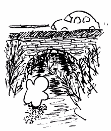
This must be the bridge over Swallow Valley. It is made of stacked stone slabs in an arch shape. I went down to the small stream to see if I could go under it, but the gorse bushes, full of thorns, were so thick under the bridge that I couldn't see the other side of the bridge, and it was impossible to go under it. I couldn't go up the stream in Swallow Valley. Too bad.
 Along with this small flow, I would go to the way of a lake seeing a Horseshoe Cave.
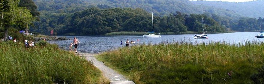
As for the beach, many sailboats were moored,and a family played with water.
I searched whether Amazon's boathouse at Beckfoot was visible in the other side, that. It was too far and did not understand.
Along with this small flow, I would go to the way of a lake seeing a Horseshoe Cave.
As for the beach, many sailboats were moored,and a family played with water.
I searched whether Amazon's boathouse at Beckfoot was visible in the other side, that. It was too far and did not understand.
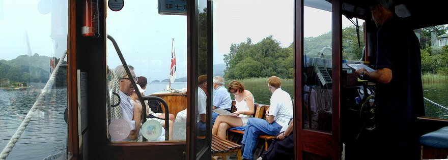
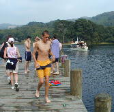
I decided to return by Coniston launch. I took off shoes and socks. I took a rest applying the foot to the lake. There would still be time by the launch came.
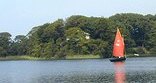
Young student's group was diving in the pier to the lake many times. A small dingy of a red sail passed.
Before long, the launch came. I wiped my foot,and wore my shoes. The customer lined up on the pier.
The captain not only steering and selling the ticket, did also the fact that the launch was connected to the pier entirely alone.
The launch returned to the north passed by the Wildcat island.